Overview
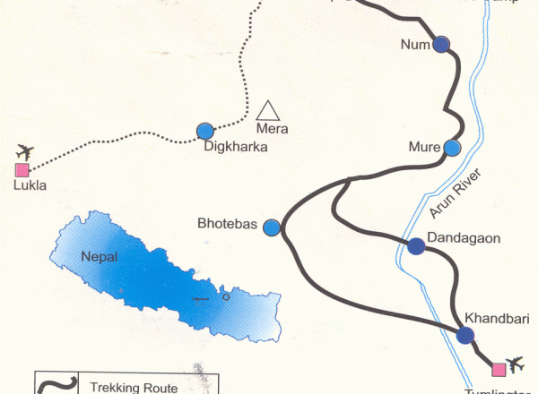
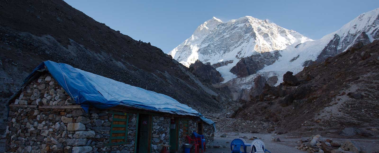
Makalu Base Camp (5250 m), now designated as Makalu Barun National Park and Conservation Area. Mt. Makalu (8463 m) is the fifth highest peak in the world. The Makalu Base camp trek is a true adventure with scenery so beautiful that it will never tire you. The trek starts with a flight to Tumlingtar and heads up the Aurn River valley to Sedua and Num, then crossing Shipton La Pass (4210 m) into the upper Barun river valley for a close look at Makalu and Chamlang Himal. This trek visits one of the most remote and unfrequented areas of Nepal. The Barun valley is a part of a huge international protected area under the agreement between the governments of Nepal and China, which comprises of 2330 sq. km of National Park and 830 sq. km of conservation area in Nepal.
Outline Itinerary
Detailed Itinerary
Day 01: Arrive Kathmandu and Transfer to Hotel
Our representative will picks up from Kathmandu airport and transfer to Hotel. Evening we have welcome dinner with Nepalese cultural show.
Day 02: Optional sightseeing in Kathmandu/ trek prepairation
We will have choice either join for full day sightseeing or free to prepare for your upcoming adventures.
Day 03: Fly from Kathmandu to Tumlingtar - Drive to Num
Day 04: Num (1490m) - Sedua (1460m 5/6 hrs hiking)
The trail today descends steeply from Num through the Cornfield of Lumbang. The country is particularly rocky; tiny terraces planted with corn and barley, then we have tough steep climb to Sedua. Camp
Day 05: Sedua (1460m) - Tashi Gaun (2070m - 5 hrs Hiking)
The trail crosses meadows and several streams, then climbs to the Sherpa village of Tashi Gaon, the last permanent settlement in the valley. Camp
Day 06: Tashi Gaon (2070m) - Kauma (3470m - 6hrs Hiking)
A very hard day of the trek as the trail goes up real steep. We walk through the sparse forests along the ridge over a hillock and descend a bit to Kauma at 3470 m. Camp
Day 07: A day rest in Kauma (3470m)
Today is a rest day as well as acclimatization day. We will explore around.
Day 08: Kauma(3470m) - Mumbak(3570m-5 hrs Hiking)
We again start today with a steep climb then through less steeply rhododendron forests to the top of the ridge. You will have superb views of Chamlang (7,290 m) Peak 6 (6739 m) and Peak 7 (6105 m). Then we will have a final descent through a forest of firs and rhododendrons to Mumbuk. Camp
Day 09: Mumbuk(3570m) - Neha Kharka - (3000m - 6hrs Hiking)
Today the trail descends steep gully with a stream for about 500m. The trail is ill defined, rocky and sloppy mud in places as it leads up the glacial valley. From here you can have a good views of Peak 6. Nhe Kharka is located on a large open grassy plain at an elevation of 3000 m. from here you will have great mountain views. Camp
Day 10: Neha Kharka(3000 m) - Sherson (4615 m - 7 hrs Hiking)
Trail today turns westward and leaves the rhododendron forests for alpine tundra. There are excellent views of Pyramid Peak (7168 m), Peak 4 (6720 m) etc. Sherson is at 4615 m a bit dangerous day as the altitude gains more than 1500 m but we don't have a choice because we do not have any suitable camp between Nhe Kharka and Sherson.
Day 11: Sherson (4615 m) - Makalu Base Camp (5000 m - 4/5 hrs Hiking)
Today, a gradual climb to a minor pass about 100 m . From here you will have a magnificent south face views of Makalu also you will be able to see the complete panorama of Everest and Lhotse. Camp
Day 12: Explore around Makalu Base camp
Day 13: Makalu Base camp to Neha Kharka (3000 m)
We retrace back down the Barun Valley. Camp
Day 14: Neha Kharka (3000 m) – Mumbuk (3570 m)
We continue descending back. Camp at Mumbuk.
Day 15: Mumbuk(3570 m) - Kauma (3470 m)
We trek across Shipton La and descend to Kauma.
Day 16: Kauma (3470 m) - Tashi Gaon (2070 m)
Today we walk a bit long to Tashi Gaon. Camp
Day 17: Trek to Pakuwa(1520 m)
We walk through farming settlements to the spread out Rai village. Continue in forests past several streams to Pukuwa. Camp
Day 18: Pukuwa (1520m) - Bumling (1160m)
Walk through the forests and follows some spectacular high and exposed narrow tracks as it climbs over rocky ridges. We camp across the Chhetri village of Bumling.
Day 19: Bumling-Tumlingtar - 860 m
Todays route pass through Chyawabesi before making a short climb back to Tumlingtar. Camp
Day 20: Fly from Tumlingtar to Kathmandu
We will take a early flight to Kathmandu. We will attand a farewell dinner in the evening.
Day 21: A free day in Kathmandu
Day 22: Transfer to Airport for the final departure
Cost Details
Equipments Checklist
Clothing
Warm jacket or down jacket
Water and windproof jacket, poncho or umbrella
Long sleeved synthetic fleece
Thermal underwear
Hat, pair of gloves and scarf
Comfortable hiking trousers (loose fitting)
Shorts and trousers, or skirt
2 pairs of warm wool-blend socks
2 pairs of running socks or liner socks
Proper hiking boots
Running shoes and flip-flops
T-shirts
During winter season, additional clothings may include:
The outer jacket should be warm, down jacket is highly recommended during winter season
Bring a pair of warm winter trousers, in addition to the hiking trousers
Bring at least one windproof layer of clothes, helping to reduce any chill factor influence.
Snow gaitors
Trekking Gear
Pair of polarizing sun-glasses (to be comfortable and to avoid potential snow-blindness)
Backpack and backpack cover (against rain and dust)
Map of the trekking area
Head torch, or small torch, plus spare batteries
Sleeping bag and silk liner
Water bottles
Miscellaneous
Toiletries
A small light weight and quick drying towel
Bar of soap
Sunscreen (at least SPF +20)
Earplugs
Insect repellants (for lower elevations)
First aid kid
Water purification tables or a water filter
Some Diamox pills against potential altitude sickness (if going beyond 4,000 m elevations)
Toilet paper
Optional items
Camera, battery etc
Altimeter
Compass
Binoculars
Books/magazines
Trekking poles
GPS unit
Padlocks for guest house rooms and bags
Sewing/repair kit
Pocket knife
Candles (for lodges)
Dairy or notebook plus pencil/pen
Camping
Tent
Stove and fuel
Cooking, eating and drinking utensils
Sleeping mat
Food and water (for the very remote trekking areas)


